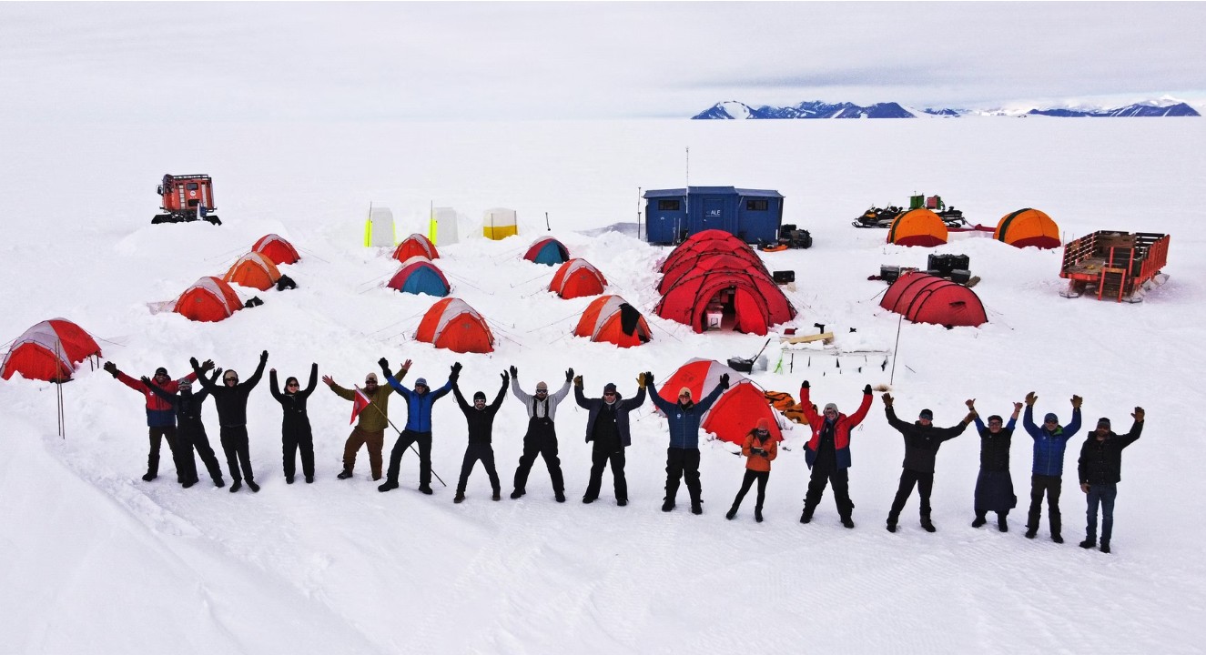
Antarctica might look like a vast, empty expanse of ice, but it’s one of the most important scientific frontiers on Earth. ALE has been integral for the operation of many scientific pursuits every season, providing logistics, flights, housing, and support personnel to help streamline objectives and maintain the safest environment possible while conducting science in Antarctica. Below are two large science projects ALE supported this season, with some insight into the importance behind the outcomes.
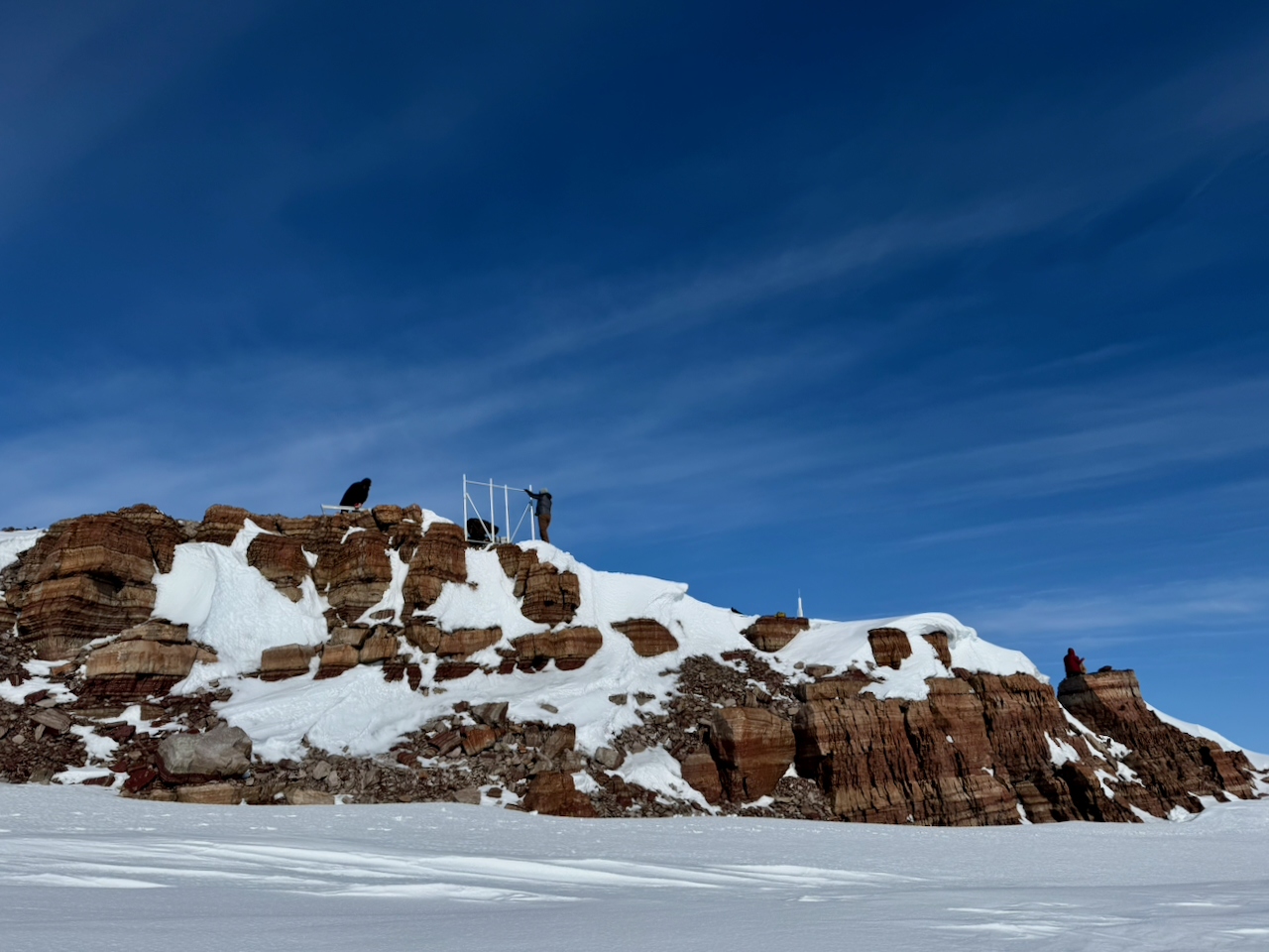
Above: After nearly 25 years of collecting data essential for understanding Antarctic ice mass change, the team removes GNSS site CRDI. Photo credit: Terry Wilson
ANET-POLENET
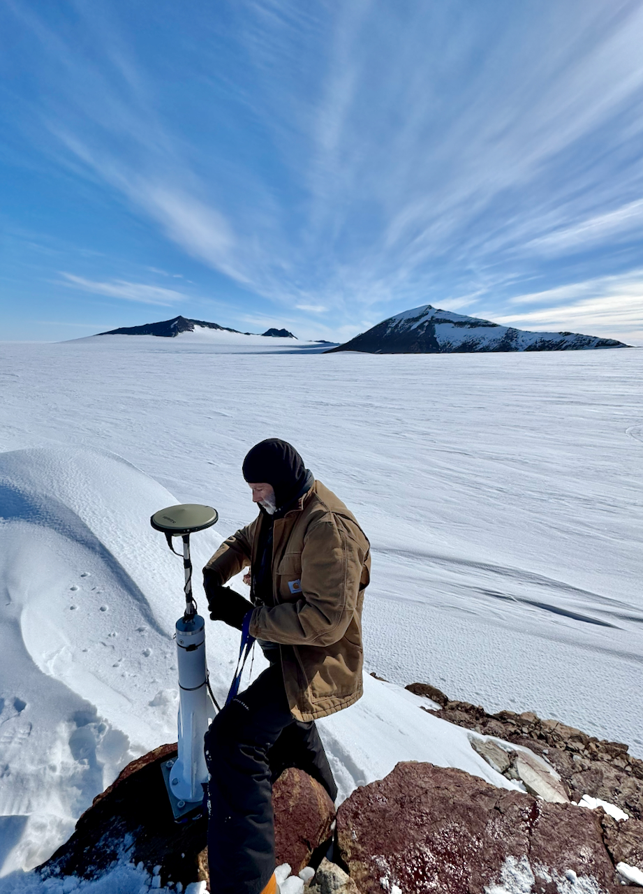
Science team member Eric Kendrick removes the GNSS antenna from site CRDI at Cordiner Peak, marking the end of direct observations of Antarctic ice mass change. Photo credit: Terry Wilson
The Antarctic Network [ANET] of the Polar Earth Observing Network [POLENET] began during the International Polar Year in 2007-08, 19 years ago. The Antarctic component of POLENET is an autonomous global positioning system (GPS) and seismic network that provides data to improve estimates of Antarctic ice mass changes and reduce uncertainties in future sea-level change projections.
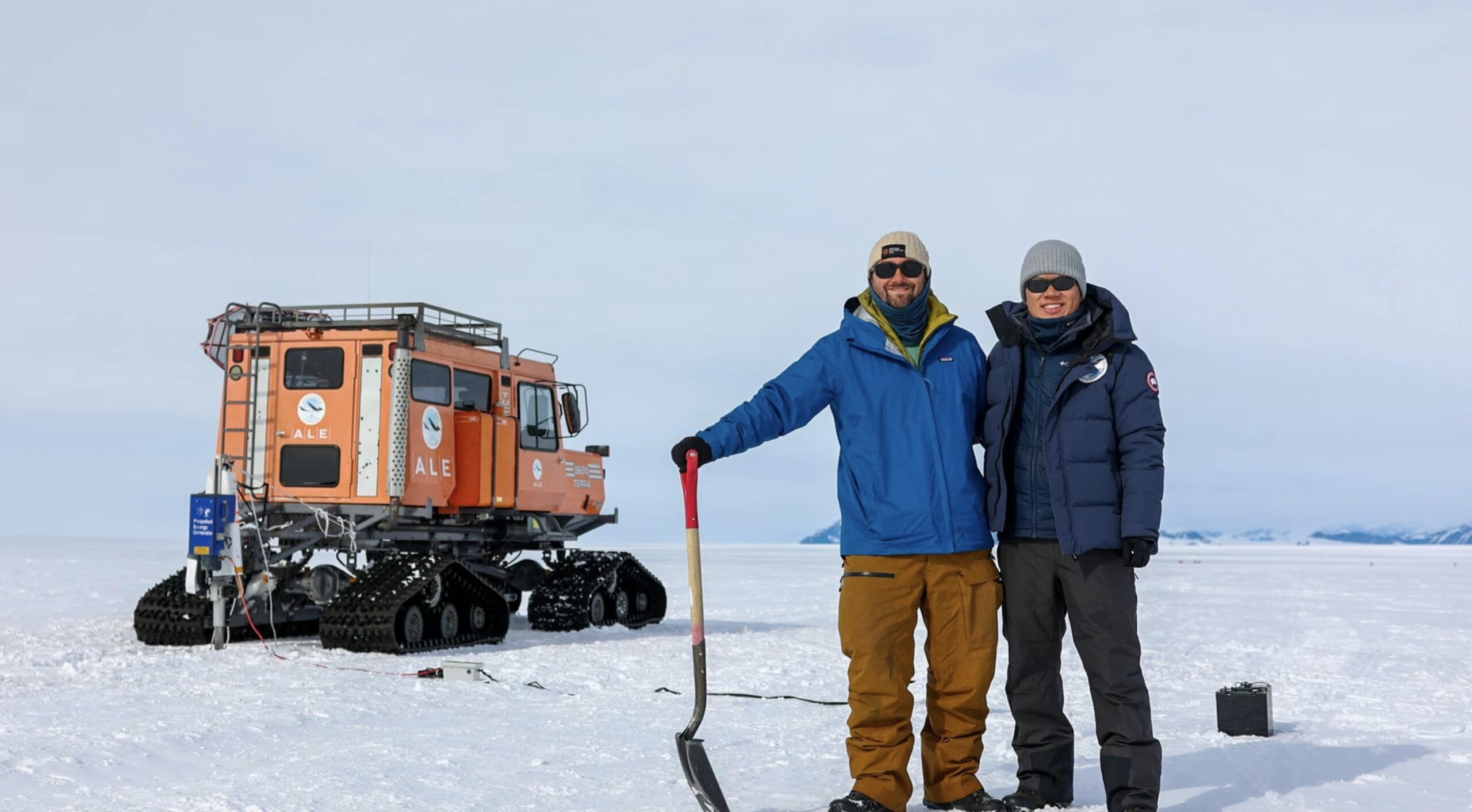
ANET-POLENET is a long-standing user of ALE’s logistics and operations for their research. This year, some GPS and Seismic instrument systems were removed, as National Science Foundation (NSF) funding is ending. In the 2025-26 season, ANET_POLENET took out 9 seismic systems and 4 GPS systems from the network. Crew includes Field Safety Guide Mark Whetu of New Zealand, Erica Lucas from UC-Santa Cruz, pilots Troy Mckerral and Marie-France Lavallée with Kenn Borek Air (KBA), Eric Kendrick and lead Principal Investigator (PI) Terry Wilson from Ohio State University, and Nicolas Bayou and Jim Normandeau from EarthScope. Terry Wilson provides some context for what this project entails:
“Two site visits are required to fully remove a GPS system. The first is solely to remove 12-18 of the 22 car batteries used to power these sites through the months of winter darkness. The second trip is to remove the rest of the system components – structural frame, electronics, GPS receiver and antenna, cables, and all the anchoring components that have held it in place. The original Cordiner GPS monument was installed in 2001 as part of the WAGN project and then was replaced by the current system in early 2008 during the International Polar Year. Like the Pecora Escarpment site, nearly 25 years of measurements of the changing position of the CRDI site have been recorded, documenting the motion of the solid bedrock as the ice sheet has changed mass with time. A bit painful for our team to remove this longstanding instrumentation…. The accumulation of equipment we have removed from sites is growing ever larger at the Thiel Corner Cache!”
ALE provided ground and air support for this research project, including intensive travel safety briefings to ensure on-the-ground operations and landings remained within safe boundaries. ALE provided meteorological forecasts and flight communications; provision of fuel at our existing caches; and laying new fuel caches at locations agreed with POLENET. ALE also accommodated the nine crew members for 41 days, including 5 days for mobilization and demobilization of POLENET’s Twin Otter crew. Science projects often require specialized equipment and backups, and ALE coordinated the shipment of science and field camp cargo both ways between Punta Arenas and Union Glacier.
To read more about their previous years of research, click HERE.
GLASS
GLASS Co-Leads Joel Steinkraus and Zhongwen Zhan after the final PEG shot, marking the completion of the active survey. Marley Parker.
A significant development in ALE’s science support this season was our partnership with the California Institute of Technology (Caltech) and NASA’s Jet Propulsion Laboratory (JPL) on the futuristic GLASS Project, funded by through Caltech’s Brinson Exploration Hub. This was the
first time ALE partnered with a science organization to develop a proposal for a research project. We then co-managed the team’s field expedition in Antarctica to a very successful conclusion. Caltech and JPL are renowned in the field of space science. By using Antarctica as a space analog, the Brinson Exploration Hub pursues transformative science while advancing the remote exploration technologies that make it possible, and expanding collaboration beyond traditional scientific programs. Based in part on field data collected by ALE Travel Safety, the Caltech/JPL team secured funding and GLASS became the Brinson Hub’s flagship project in Antarctica.
GLASS stands for GROUNDING ZONE LONG-TERM ACOUSTIC SENSING OF STRUCTURE —Led by Professor Zhongwen Zhan of Caltech and Joel Steinkraus of JPL, the project installed more than 8km of optic fiber in Constellation inlet and, using a technique known as ‘distributed acoustic sensing’, aimed to create the first-ever film of ice-structure in motion. This was in addition to producing high-resolution seismic measurements of the ‘grounding line’ — that area where a floating ice shelf meets the continental ice sheet. Then, using an experimental system, the team also conducted the first ever ground penetrating radar survey to the base of the ice shelf in Constellation Inlet. Together, these measurements allowed the team to look at how the grounding line is affected by the melting that takes place at the base of the shelf due to warming sea water caused by climate change, and how this then affects the flow of ice. Such research is critical for the long-term monitoring of the Antarctic cryosphere which is essential for our understanding of ice shelf stability and its impact on sea level rise. Having proven the technology so successfully, the longer-term aim is to deploy a similar system on the surface of the Moon or other planetary bodies to develop our understanding of planetary geology. ALE was instrumental in the development of this project from conception through to delivery, and we oversaw all the field logistics and safety of the project on the ground. ALE was responsible for:
- Reconnaissance survey of the study area using ground penetrating radar
- Initial field data collection using GPS sensors
- Project planning
- Advice and consultation on project permitting
- Field transportation
- Science camp build and management
- Field catering
- Communications
- Medical
- Field safety
Read more HERE.
ALE is already planning to build on this experience for other related science projects in West Antarctica during the 2026–27 season.
The CalTech GLASS team at their remote camp. Marley Parker, Caltech