Have you ever wondered how a place or feature is named in Antarctica? Who decided to call it Elephants Head or Dronning Maud Land or the Sentinel Range? And does everyone agree on these names?
History of Antarctic Naming
Throughout history, people have named the places where they have lived and traveled. From countries and continents to local landmarks, place names form part of our human experience. Antarctica is no exception, in that most of its major features have been named. It is unique, however, in that it is the one continent that does not have a native population and until the first voyages of discovery, place-names did not exist for any of its features or geographic areas.
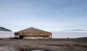
As explorers began mapping the coastlines, they named the lands and features they encountered, often claiming swaths of territory for national interests. Newly-found lands and features were named in honor of monarchs (Dronning Maud Land (NOR), Edward VII Land (GBR)), high ranking officials (Graham Land after the head of the British Admiralty), expedition sponsors (Beardmore Glacier), and explorers themselves (Palmer Land). Other names arose informally from day-to-day expedition activities. Hut Point is the location of the British Antarctic Expedition’s 1901-04 base and The Gateway is a pass from Ross Ice Shelf to the mouth of Beardmore Glacier.
The International Geophysical Year (1957-58) and the signing of the Antarctic Treaty (1959) led to an explosion of Antarctic research, exploration, and place naming. The Ellsworth Mountains were mapped in detail by the USGS (1958-66) and named by the US Advisory Committee on Antarctic Names (US-ACAN) after Lincoln Ellsworth, who discovered the range during his 1935 transantarctic flight. The USGS further divided the Ellsworths into the Sentinel (northern) and Heritage (southern) ranges. Because the USGS is an American entity, features within the Heritage Range were given American-heritage themed names, like Union Glacier, Patriot Hills, Independence Range, and Pioneer Heights. University of Minnesota expeditions conducted cartographic and geologic surveys of the Heritage Range during the 1962 and 1963 seasons, yielding names such as the Minnesota Glacier, Mount Dolence, and Soholt Peaks (named after geologists on the expedition).
Multiple Names
The manner of Antarctic discovery and mapping, and the lack of a single authority for geographic names under the Antarctic Treaty System, have resulted in numerous cases where multiple names have been given to a single feature and inconsistent practices in the use of existing names. The fact that place-names are intrinsically related to territorial claims only makes a solution to the problem more difficult. As early as 1912, Edwin Blach highlighted the challenges of Antarctic place names, in the Bulletin of the American Geographical Society. (https://www.jstor.org/stable/pdf/200101.pdf)
A prime example is the Antarctic Peninsula, which lies within the UK, Chilean and Argentine claims, and has been called Graham Land (UK), Tierra San Martin (Argentina), Palmer Peninsula (US), and Tierra de O’Higgins (Chile). In 1964, the UK and US agreed to name the northern part of the Antarctic Peninsula Graham Land and the southern part Palmer Land. However Chilean maps still refer to the area as Tierra de O’Higgins.
Creation of SCAR Composite Gazetteer
At the XXII Scientific Community on Antarctic Research (SCAR) meeting in Bariloche, Argentina, in 1992, SCAR’s Working Group on Geodesy and Geographic  Information initiated a new program designed to bring some order to Antarctic toponymy. The specific goals were to develop two new products for the Antarctic community: a compilation of all existing Antarctic place-names, known as the SCAR Composite Gazetteer of Antarctica (CGA); and guidelines for creating new place-names, and for the use of existing names.
The CGA is a collection of all those names of features that have been submitted by representatives of national gazetteers. Each feature has been assigned a numerical Unique Identifier code (UID) to connect the various place names to that feature. Since 2008, Italy and Australia jointly have managed the CGA.
In the 200 years since the discovery of Antarctica, the continent has gone from a completely unnamed area to having 38,054 names that correspond to 19,963 features according to the SCAR Composite Gazetteer. The continuing need for scientists, researchers, and explorers to refer precisely to places means that there will be a continuing need to name the un-named.